Read Longitude and Latitude from Google Earth
緯度経度をGoogle Earthより読み込み
概要
緯度経度をGoogle Earthより読み込む機能が参考機能として追加されました。
サポート範囲は全世界です
本機能は、2008年版以降で動作し、2008年版は試用期間となり、2009年版より正式機能と成ります。
使い方
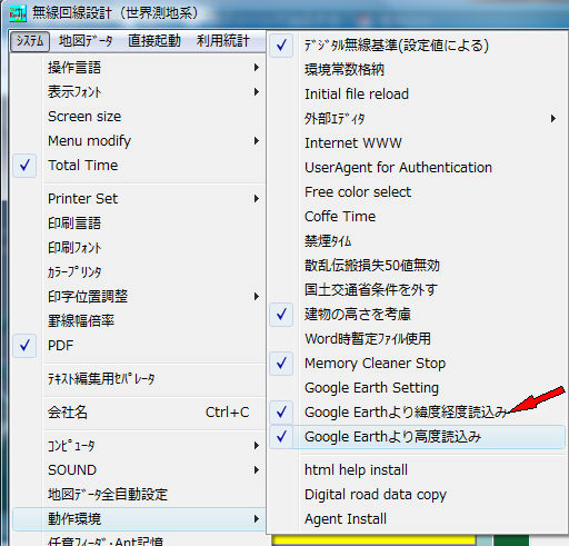
1.設定
Google Earthより緯度経度読み込みをチェック。
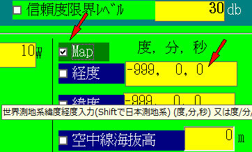
2.緯度経度入力
Mapをチェックし、緯度経度入力ウインドーをマウスでクリック。
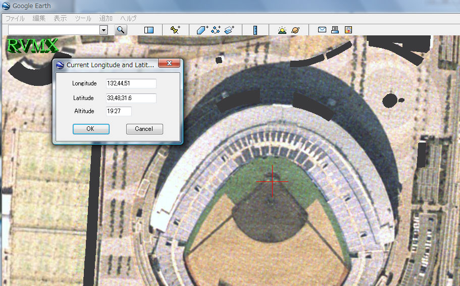
3.Google Earth上で位置を指定
マウスで十字の中心を目的位置に合わせ、OKボタンをON。
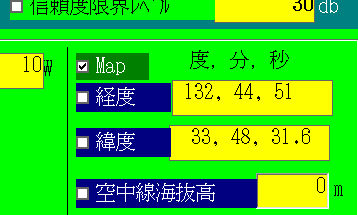
4.結果
緯度経度が設定されます。
但し、Google Earthがインストールされている必要があります
また、この機能は、Google Earthのサービスが提供されている間のみ有効です
提供ソフトのQ&A
(有)RVMX

