RVMX GIS ViewerでKMZ/KML出力時に白の背景を透過させる
RVMX GIS ViewerでKMZ/KML出力時に白の背景を透過させる
概要
RVMX GIS Viewerでサービスエリア図等をKMZ/KML出力時に白の背景を透過させる機能です。
RVMX GIS ViewerよりGoogleEarthで表示されるときの補助機能です。
2015年は試用で、2016年版より正式機能と成ります。
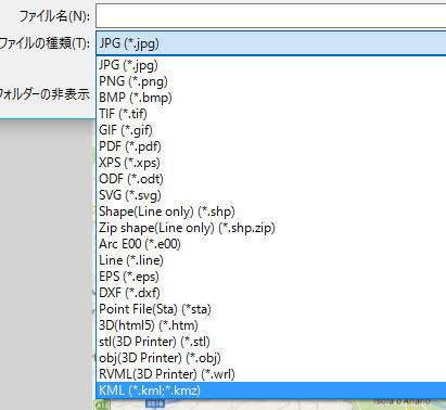
1.利用方法(画像として)
-1.背景地図を白地図とする
-2.KMZ/KMLで白を透過にチェック
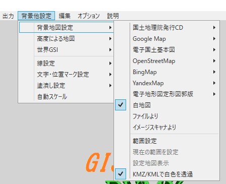
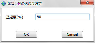
-3.透過度を設定
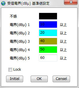
-4.サービスエリアの時、電界値と色を指定
この機能はシステム->システム線色・幅使用にチェックが入っているときに有効
オプション->参照画像・基準値->基準値設定->サービスエリア基準値->電界
-5.GISデータファイル(mobil)を読み込み

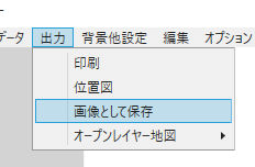
-6.KMZへ出力、

2.利用方法(GIS[ベクターデータ]として)
-1.KMZ/KMLで白を透過にチェック
-2.透過度を設定
-3.サービスエリアの時、電界値と色を指定
この機能はシステム->システム線色・幅使用にチェックが入っているときに有効
オプション->参照画像・基準値->基準値設定->サービスエリア基準値->電界
-4.GISデータファイル(mobil)を読み込み
-5.KMZへ出力、

3.利用例
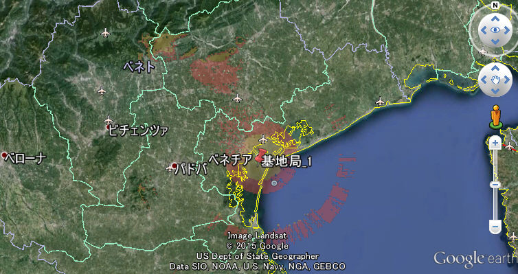
-1.画像として出力でKMZ/KMLで白を透過にチェック時
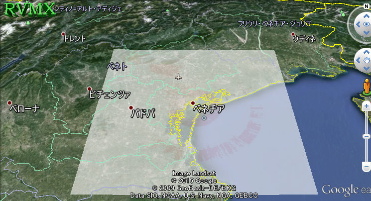
-2.GISとして出力でKMZ/KMLで白を透過にチェック時
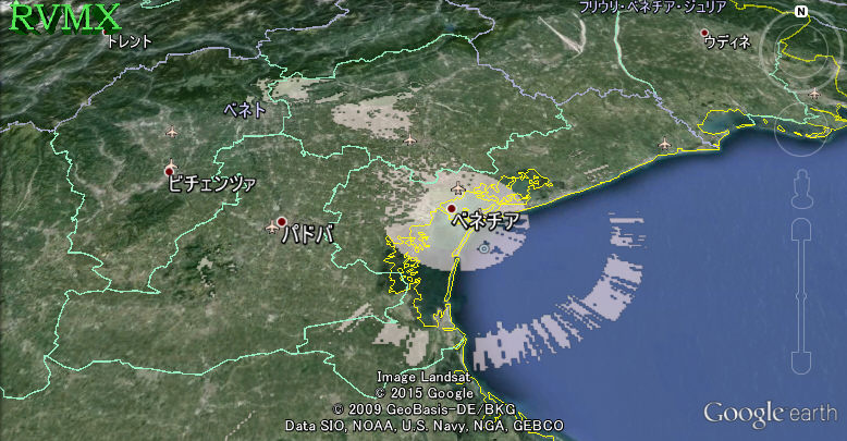
-3.KMZ/KMLで白を透過にチェックOFF時
4.その他
-1.目的のデータの色に白を使っていると、透過されます。
-2.エリア内全てが着色されていると、透過する部分はありません。
-3.画像として作成した時は、白地図の上に描くため、指定した色より白っぽくなります。
-4.GISとして作成した時は、あまりベクトルデータ数が多いとGoogleEarth側でエラーを起こすかもしれません。
注意:.Net Framework4.5以上がインストールされている必要が有ります。
基本機能説明へ
提供ソフトのQ&A
(有)RVMX

