RVMX BingMap Tool
RVMX BingMap Tool
概要
BingMapの地図を利用するToolです。
利用例,RVMX GIS Viewer 無線回線設計 警報音シュミレーション他Bing Maps操作Toolです。
Microsoft提供の全世界対応地図BingMapを利用出来るようにする為、対応しました。
また、この機能を利用するにはBing Mapsのライセンスキー(Trial or Basic or Enterprise)が必要です。*1:
2013年版以降で動作し、2013年版は試用期間となり、2014年版より正式機能と成ります。
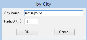
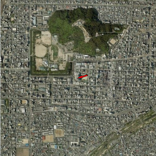 松山市 半径1Kmで作成例
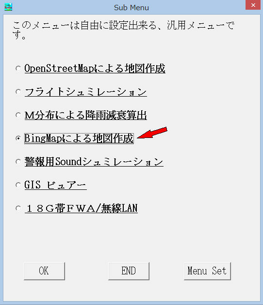
1.利用方法
-1.RVMX_GISViewerでの利用例
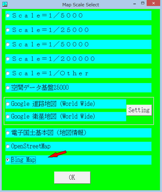
a.背景他設定->背景地図設定->BingMap->Bing衛星地図又はBing道路地図を選択
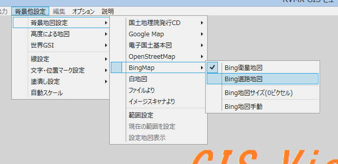
b.地図のサイズ設定
背景他設定->背景地図設定->BingMap->Bing地図サイズをクリツク
c.手動で任意範囲の地図作成
背景他設定->背景地図設定->BingMap->Bing地図手動をクリツク
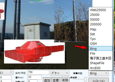
-2.回線設計より手動で任意範囲の地図作成
サブメニュー、より起動
-3.回線設計より自動での利用
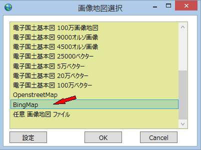
-4.警報音シュミレーションよりの利用
-5.FWA・無線LANよりの利用
2.手動で任意範囲の地図作成方法
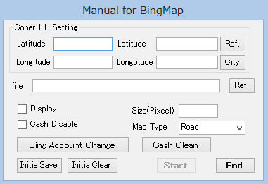
a.ConerLL Setting 対角の緯度経度設定
a-1.Longitude 経度
a-2.Latitude 緯度
a-3.Ref. 緯度経度付き画像より読み込み
a-4.City 都市名と半径指定により範囲指定
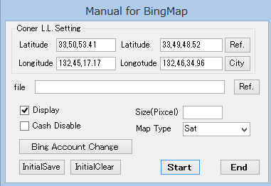
b.file 出力用ファイル
b-1.ref. ダイアログボツクスより選択
無指定の時は、出力はされません,ただし表示にチッェクがあると表示はされます
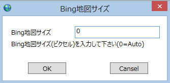
c.Size(Pixcel) 出力画像の最大ピクセル数(1辺の)
0の時は自動設定(1000)
ちなみに、1000で32Bitカラー保存時,BMPで4GBとなります。圧縮機能のあるjpg等では圧縮効果によりもっと小さくなります。
d.Display 作成後表示
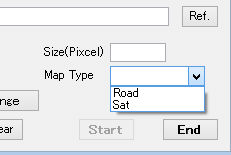
e.MapType 地図の種類
Road 道路
Sat 衛星
f.Cash disable キャッシュを利用しないで、インターネットより地図を取得(地図を更新時に対応のため)
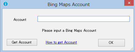
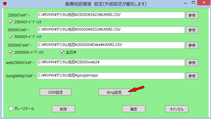
g.Bing Account Change 登録Bing Maps Key(アカウト)の変更
h.Cash Clean キャッシュより指定日数以前のものを削除
i.Intialsave 種類とサイズ及びCash disableを保存し、自動作成時に反映させる
j.Intialclear 種類とサイズ及びCash disableを保存を削除
k.Start 開始
l.End 終了
3.地図作成中の表示

このWindowを×で閉じると中断します
4.ネツトワーク環境でプロキシ認証等が必要な時
inttoolini.datファイルをルートフォルダーへ配置
内容は下記の必要な項目のみを記述してください。
プロシキ認証が必要な時
proxyhost,プロシキ名
proxyid,プロシキID
proxypass,プロシキパスワード
ID・パスワードが必要な時
ID=aaa パスワード=bbbの例
id,aaa
password,bbb
Agentが指定されているとき
agent,指定Agent
をメモ帳で作成。
inttoolini.datファイルの内容は一度実行するとセキュリティのため暗号化され、見ても意味の分からないないとなります
この設定は,OSM等の設定と共通です
5.作成例
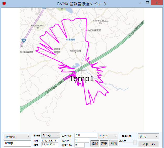
警報音シュミレーションで衛星地図
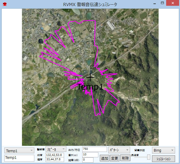
警報音シュミレーションで道路地図
6.Bing Maps Key取得について(*1:)
-1.Keyの種類(下記の3種類)
a.Trial
・無料で取得可能
・90日で期限切れとなる
・Basicキーに移行不可能
・課金対象となるトランザクションが最大で10,000/30日まで無料で使用可能
b.Basic
・無料で取得可能
・一般コンシューマー向けのアプリケーションに利用できる(業務アプリなど組織内の限られた人間が利用するアプリには使用できない)
・その他の利用制限事項については利用規約を確認
c.Enterprise
・有料
・TrialもしくはBasicに当てはまらない形態でBing Mapsを利用したい場合の有償契約オプション。
-2.取得サイト
-3.Bing Maps Key取得方法
7.その他
自動作成時の地図の種別は事前に、手動設定画面で選択後Intialsaveボタンを押してください。
警報音シュミレーションでは、下記のボタンより行えます。
注意:.Net Framework4.0以上がインストールされている必要が有ります。
地図の利用はBing Mapsの利用規定に従ってください
Bing Mapsの仕様変更などにより、この機能が停止することが有ります
提供ソフトのQ&A
(有)RVMX

